Cosa vedere in Calabria: le grotte di Trachina a Palmi e il commercio con i popoli del mare
La grotta della Pietrosa (o grotta di Tràchina), che nel catasto è siglata come Cb 182, è una grotta posta nell'omonima località del comune di Palmi. Con i rinvenimenti, databili all'Età del Bronzo e al Periodo elladico, ritrovati nella grotta, si può chiarire ulteriormente le relazioni che avvenivano tra le popolazioni locali del tempo e quelle egee
Storia
Nel periodo 1991-1993 vennero effettuati, all'interno della grotta, scavi sui livelli dell'età del bronzo a cura dell'Istituto italiano di archeologia sperimentale di Genova, per conto della Soprintendenza archeologica della Calabria.
Gli scavi effettuati sul "vano" principale della grotta non diedero risultati stratigrafici ma portarono rinvenimenti nel piccolo "vano" sud, a riprova dell'utilizzazione di quest'ultimo, da parte degli abitanti dell'epoca, in quanto creava maggior riparo.
Gli archeologi ipotizzano che la grotta fosse utilizzata dall'Età del Bronzo Antico, grazie ai rinvenimenti degli scavi del 1995.
Anche in età medievale, moderna e contemporanea l'ampio vano sotterraneo fu sfruttato come ricovero per le greggi
Descrizione
A 90 metri sul livello del mare, affacciata sulla Costa Viola, si trova la Grotta di Pietrosa, un antro enigmatico che custodisce i segreti di epoche remote. La sua ampia apertura, di 17 metri di larghezza e 5 di altezza, offre un varco verso un passato ricco di fascino e di mistero.
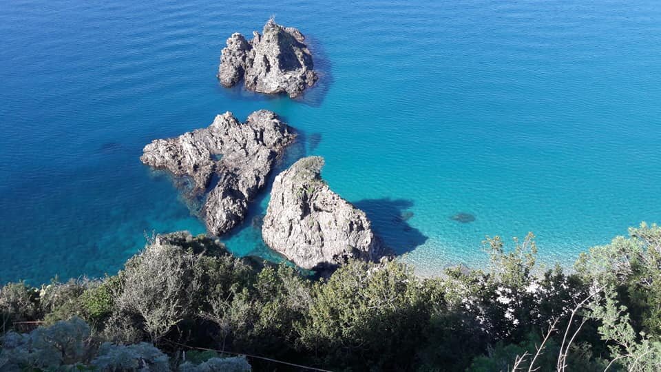
Un sentiero sterrato conduce alla grotta, immersa nella quiete di una campagna baciata dal sole. Da qui, lo sguardo si perde nell'infinito blu del Mar Tirreno, che si estende dallo Stretto di Messina fino a Capo Vaticano, abbracciando le Isole Eolie in un panorama mozzafiato.
Due ingressi distinti conducono all'interno della grotta, un ambiente unico e suggestivo. La luce naturale illumina le pareti rocciose, sulle quali si possono ammirare agglomerati di litodomi, testimoni di un tempo in cui la grotta era sommersa dalle acque del mare.
Dodici strati archeologici raccontano la storia millenaria di questo luogo. Tracce di focolari e resti di vita quotidiana ci parlano di popoli che hanno abitato la grotta in epoche diverse, lasciando la loro impronta indelebile.
Un riparo naturale, offerto da una minore quota del paleosuolo e da blocchi franati all'ingresso, ha reso la grotta un rifugio sicuro per gli antichi abitanti. La sua posizione strategica, con vista panoramica sul mare, ne ha fatto un punto di osservazione privilegiato e un luogo di culto e di vita.
La Grotta di Pietrosa è un invito a esplorare la storia, a immergersi nella bellezza selvaggia della Costa Viola e a lasciarsi catturare dal fascino di un luogo che ha visto il susseguirsi di epoche e di culture.
Un sito archeologico di grande valore, che merita di essere conosciuto e protetto, per custodire la memoria del passato e tramandarla alle future generazioni
Reperti
I reperti rinvenuti nella grotta sono ceramiche principalmente della fase tarda dell'età del Bronzo mentre alcuni cocci sono interpretabili come importazioni dell'area egea. Ciò porta a pensare che le coste tirreniche calabresi rientrassero nelle rotte del commercio miceneo.
Inoltre….
Frammenti di ceramica ad impasto, databili tra il 2500 e il 1500 a.C., raccontano di una frequentazione preistorica della grotta. Un salto nel tempo ci porta all'età medievale, testimoniata da reperti ceramici di epoche più recenti.
Un deposito di ossa animali, stratificato sotto la parete est, stuzzica la nostra curiosità. Le ossa, con evidenti tracce di calcificazione, potrebbero essere coeve alla ceramica preistorica, aprendo nuovi scenari sulla vita in questa grotta millenaria.
Salendo un viottolo che costeggia la parete sud, si raggiunge un piano superiore. Qui, una seconda grotta si affaccia sul mare con una vista mozzafiato: lo Stretto, la Sicilia, le Eolie e Capo Vaticano si dispiegano in un panorama di incomparabile bellezza. La sua posizione strategica suggerisce una funzione di avvistamento, una sentinella silenziosa a guardia della costa.
Non mancano le tracce di scavatori clandestini, che hanno danneggiato la stratigrafia del terreno. Le loro buche, come ferite nella roccia, raccontano di una caccia al tesoro che ha deturpato questo luogo sacro alla storia.
Ricerche hanno confermato l'importanza archeologica di questa zona. Nel 2006, a Rovaglioso, la scoperta di un "campo di urne" ha portato alla luce la presenza di una necropoli Tauriana, risalente al XII secolo a.C.
I Tauriani, una popolazione italica, si erano stanziati in questa zona, fondando la città di Taurianum. La loro presenza è testimoniata da numerosi siti archeologici, tra cui un fortino a Serro di Tavola e presidi sulle colline aspromontane.
La costa da Rovaglioso al pianoro di Taureana è ricca di insediamenti e necropoli Tauriani.
La Grotta di Trachina con la sua stratificazione di epoche e la sua vista panoramica, si erge a simbolo di questa terra ricca di storia e di fascino.
Un invito a esplorare, a conoscere, a perdersi nei sentieri del tempo che conducono alle radici della nostra civiltà.

Foto Sopra: In località Rovaglioso (Porto Oreste), non lontano dalle grotte di Trachina nella proprietà Cordopatri, durante la piantumazione di alberi, contadini hanno casualmente scoperto grandi anfore contenenti tracce di ossa umane mescolate a cenere. Il ritrovamento è stato descritto come la scoperta di pietre disposte a formare un muro a secco a piramide durante lo scavo per piantare alberi. Un frammento spesso di terracotta è risultato essere il bordo superiore di una grande anfora, che, purtroppo, si è frantumata durante il tentativo di estrazione. La testimonianza di questo ritrovamento è stata comunicata alla Soprintendenza Archeologica della Calabria. L'Ispettore ai monumenti, Antonino Raneri di Bagnara, ha esaminato i cocci e ha ipotizzato che potesse trattarsi di un "campo di urne", una pratica funeraria delle popolazioni italiche del XII secolo a.C. diffusa in tutta la penisola, particolarmente associata alle popolazioni identificate come "Tauriani". Considerando la presenza della città dei Tauriani, fondata da loro stessi nel nostro territorio, si ritiene probabile che lungo la costa da Rovaglioso al pianoro di Taureana possano esserci stati insediamenti e necropoli Tauriani.
Approfondimenti


.


.jpeg)

